
The Earth is flat
Scientific Reality
Earth is an oblate spheroid — confirmed by geometry, physics, satellites, and direct observation.
Historical & Cultural Context
Everyday intuition and simplified classroom explanations hardened into "common knowledge" long before careful measurement caught up. As a question of geoscience, "The Earth is flat" slotted neatly into what people already expected to be true, which is exactly why it went unquestioned for so long.
Because it sounded reasonable and was taught early, few adults ever revisited it. It was not until 240 that the record was set straight — earth is an oblate spheroid — confirmed by geometry, physics, satellites, and direct observation. The correction came from Eratosthenes (~240 BCE), NASA Earth Observing System (1999–present), yet the original myth still lingers in everyday conversation.
A Different Lens
Intuition is a terrible instrument for reality. This myth persists because the truth is counterintuitive — and being wrong felt perfectly logical. It survives not because it is convincing but because it is so rarely challenged out loud. Strip away the folklore and the sharper truth comes into focus — start with a single fact: eratosthenes measured circumference to within 2% accuracy in 240 BCE. Seen this way, the myth is less a mistake to mock than a case study in how belief outruns evidence.
Deep Dive
Eratosthenes calculated Earth's circumference within 2% accuracy using shadow angles in 240 BCE. Since then, the spherical Earth has been confirmed by celestial mechanics, circumnavigation (Magellan, 1522), the physics of gravity (which pulls mass into spheres), GPS satellite timing, and over 1.5 million orbital photographs. The Earth is technically an oblate spheroid — slightly flattened at the poles by rotation — with an equatorial radius of 6,378 km and polar radius of 6,357 km.
- Eratosthenes measured circumference to within 2% accuracy in 240 BCE
- Equatorial radius: 6,378 km; polar radius: 6,357 km (oblate spheroid)
- GPS timing calculations would fail within minutes on a flat model
- Over 1.5 million orbital photographs confirm curvature from all angles
Visualization
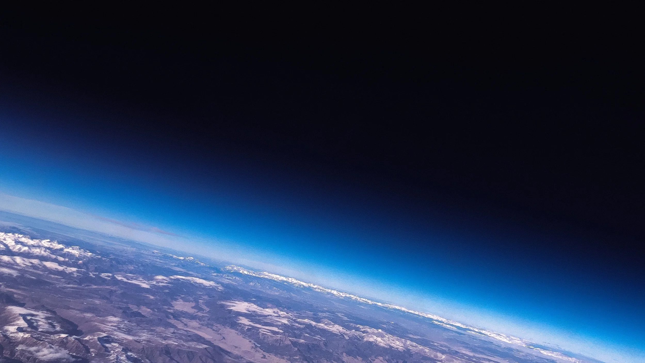
Earth's Curvature — High-Altitude Balloon Photograph
High-altitude balloon photograph showing Earth's curvature and atmospheric limb against the black of near-space. This image is taken from ~35–40 km altitude — accessible to any team with a weather balloon. The spherical curvature is unmistakable and reproducible by anyone. A flat disc would not produce this horizon geometry from any altitude.
Verified Sources & Peer-Reviewed References
Eratosthenes: Measurement of the Earth
History of Science Society·1953DSCOVR Mission Overview and EPIC Instrument
NASA Goddard SFC·2015GPS Signal Propagation and Spherical Earth Model
IEEE Transactions on Aerospace·2018Geodesy and the Shape of the Earth
U.S. National Geodetic Survey·2020
All sources are peer-reviewed or from accredited space agencies. Dark Myths does not fabricate or misrepresent scientific findings.